UPDATE 6:40 p.m.
More Westbank and West Kelowna residents are heading home this evening.
Hundreds of properties in West Kelowna Estates have been downgraded to an evacuation alert.
Residents can check what properties are on alerts and orders on the Central Okanagan Emergency Operations map.
UPDATE 11:35 a.m.
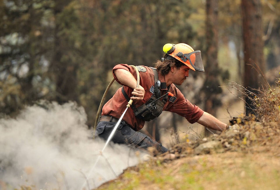
BC Wildfire Services will be executing a 20-hectare planned ignition at the south flank of the fire, northwest of Shannon Lake Golf Course.
“The crews have spent the last two days preparing hose lines and hand guards to address the pockets of unburned fuel on the steep slopes that could challenge containment in the future,” said senior wildfire officer Brian Litke in Thursday’s RDCO update.
“The purpose of the planned ignition is to remove unburnt fuel in an intentional way to secure the control line and fire,” said the BC Wildfire Services. “Based on current conditions this unburnt fuel has the potential to burn on its own in a significantly more active way.”
It also allows fire crews to create a more uniform edge, making direct attacks and extinguishing hot spots easier.
The BC Wildfire Service continues to respond to the McDougall Creek wildfire (K52767) adjacent to West Kelowna. pic.twitter.com/jdxBbzcYgD
— BC Wildfire Service (@BCGovFireInfo) August 24, 2023
Original
The McDougall Creek wildfire remains at 12,318 hectares as the sun rises on Thursday, Aug. 24.
On Wednesday, Central Okanagan Emergency Operations (COEOC) rescinded some evacuation orders by downgrading them to alerts. This means the residents who live at these addresses can return home but must still be ready to leave at a moment’s notice. The properties that were on order but are now on alert are:
- 2210, 2149, 2155, 2182 and 2232 Horizon Drive;
- South of Shannon Lake Road and Alexandria Way, properties from 2890 through to 2972 Shannon Lake Road;
- 2735, 2649, 1850 and 2025 Shannon Lake Road;
- All properties along Alexandria Way, Moore Drive, Shawna Court, Helgason Drive, Golf Course Drive, Shannon View Drive, Cornerstone Drive and Hedgestone Drive.
For a map of evacuation orders and alerts visit cordemergency.ca/map.
COEOC will provide an update on the three Central Okanagan wildfires at 10 a.m. Thursday.
There are 84 properties in West Kelowna and the Westbank First Nation that suffered damage as a result of the wildfire, and 90 in the RDCO’s West electoral area.
The McDougall Creek fire in West Kelowna is part of the Grouse Complex, which also includes the Walroy Lake wildfire in Kelowna and the Clarke Creek wildfire in Lake Country.
The Central Okanagan Emergency Operations Centre will provide a news conference and online streaming update for media about the response to the McDougall Creek wildfire impacting West Kelowna, Westbank First Nation and the Regional District of Central Okanagan West Electoral Area.
Time: 10 a.m. PDT
Transport Canada and the BC Wildfire Service prohibit the use of drones of any size near a wildfire. The operation of any aircraft not associated with fire suppression activities within a radius of five nautical miles around a fire, including unmanned aerial vehicles (UAVs or drones), is illegal. Anyone found interfering with wildfire control efforts may face penalties up to $100,000 and or up to one year in jail.
Black Press Media will keep updated throughout the day.
READ MORE: North Shuswap on edge after alleged incident on Highway 1 amid wildfire
@cunninghamjordy
jordy.cunningham@kelownacapnews.com
Like us on Facebook and follow us on Twitter and subscribe to our daily and subscribe to our daily newsletter.