UPDATE: 7:55 p.m.
Severe thunderstorms are expected to hit the North Okanagan on Tuesday, Aug. 22 evening. According to Environment Canada, a line of thunderstorms are being tracked, stretching from Oyama, northwards through Beachcomber Bay, primarily impacting Vernon.
There is potential for heavy downpours, which can cause flash floods and water pooling on roads.
UPDATE: 12:55 p.m.
A special weather statement for the Okanagan Valley has been put in effect. According to Government of Canada weather, there is potential for localised heavy downpour in thunderstorms resulting in runoffs or debris flow over burned areas.
Thunderstorms are expected to develop late this afternoon and this evening. Some will be severe, producing 15 mm/hr rainfall rates.
The sudden burst of rain may result in a sudden rise in the river and creek levels.
To report severe weather, email BCstorm@ec.gc.ca, or tweet reports using #BCStorm.
ORIGINAL: 7:40 A.M.
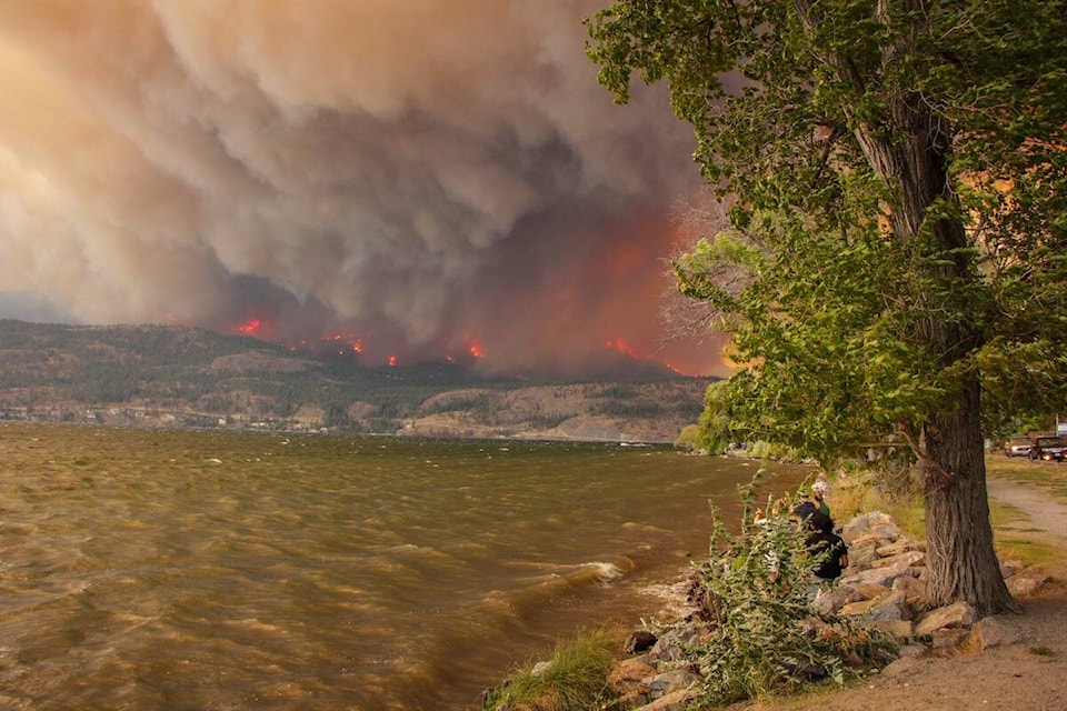
Some relief could be on the way for the wildfires across the Okanagan.
A special air quality statement from Environment Canada remains in effect for the entire the Okanagan despite seeing much-improved air quality overnight and into Tuesday morning.
According to the website IQAir, Kelowna’s air quality index remains unhealthy at 172 Tuesday morning. Despite being unhealthy, it’s a vast improvement from sitting at a hazardous score of 289 on Monday.
Penticton currently sits at an air quality index of 203 (sixth worst in the province) while Summerland is at 219 (fifth) and Kamloops is at 260 (fourth).
Throughout the Okanagan on Aug. 22, it’s mostly cloudy with widespread smoke. In the morning, there is a 30 per cent of rain and that increased to a 70 per cent chance in the afternoon.
There is also a risk of thunderstorms but there is not a thunderstorm warning in effect. Winds could reach 20 km/h. For the majority of the Okanagan, it is expected to reach 22 C.
The rain is expected to bounce around from 30 to 70 per cent throughout both Tuesday and Wednesday. Precipitation is expected to help the all the wildfires throughout the Okanagan.
READ MORE: Premier to get first-hand look at fire damage in B.C.’s southern Interior
@cunninghamjordy
jordy.cunningham@kelownacapnews.com
Like us on Facebook and follow us on Twitter and subscribe to our daily and subscribe to our daily newsletter.