Summerland Museum
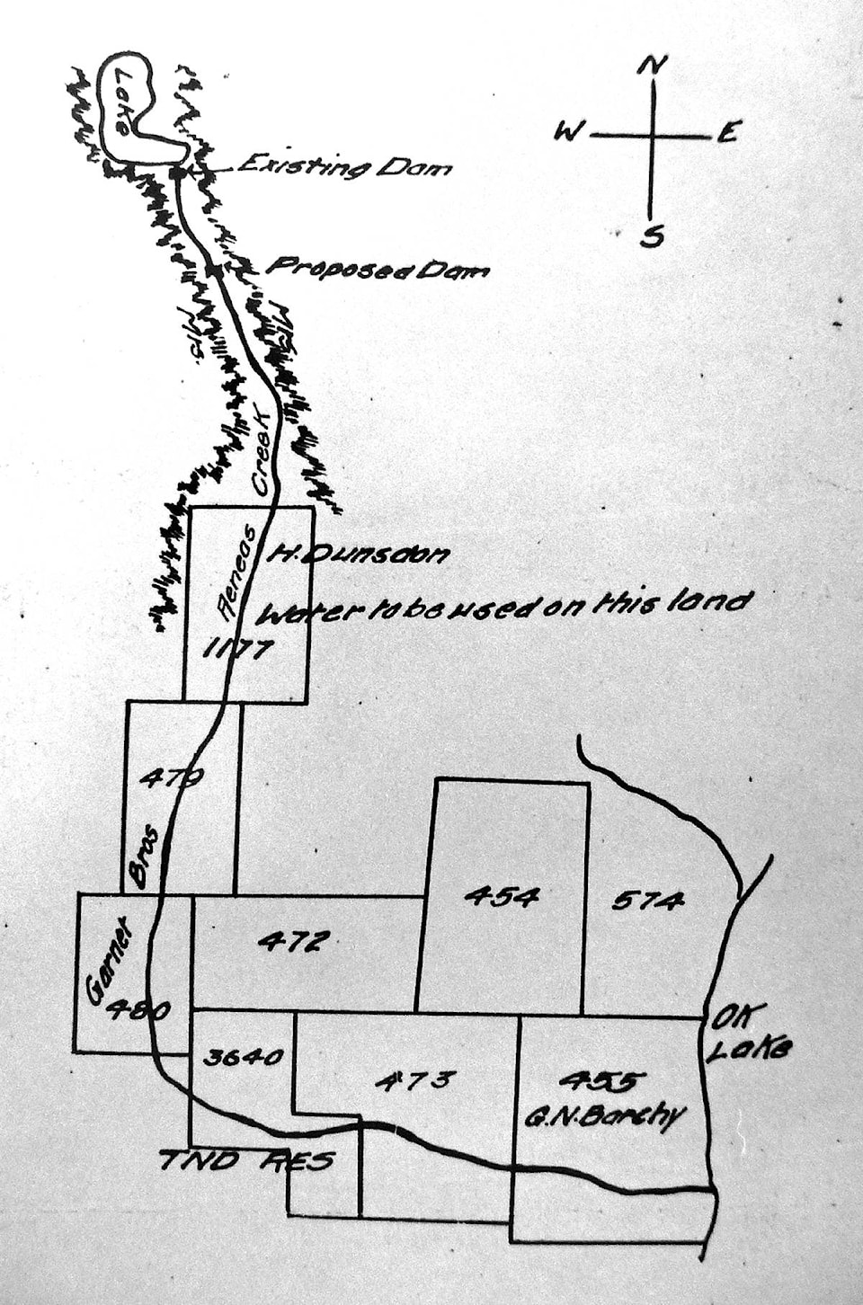
This map is dated Nov. 13 1897. It was drawn by Harry Dunsdon.
He was asking permission from the province, to place a second dam on Aeneas Creek.
The cost to do this in 1897 was 50 cents.
The top of the map shows Garnett Lake and Aeneas Creek flows through the Dunsdon property, the Garnett brothers’ land, Indian Reserve #3 (now downtown Summerland) and exits into Okanagan Lake through George Barclay’s peach orchard.