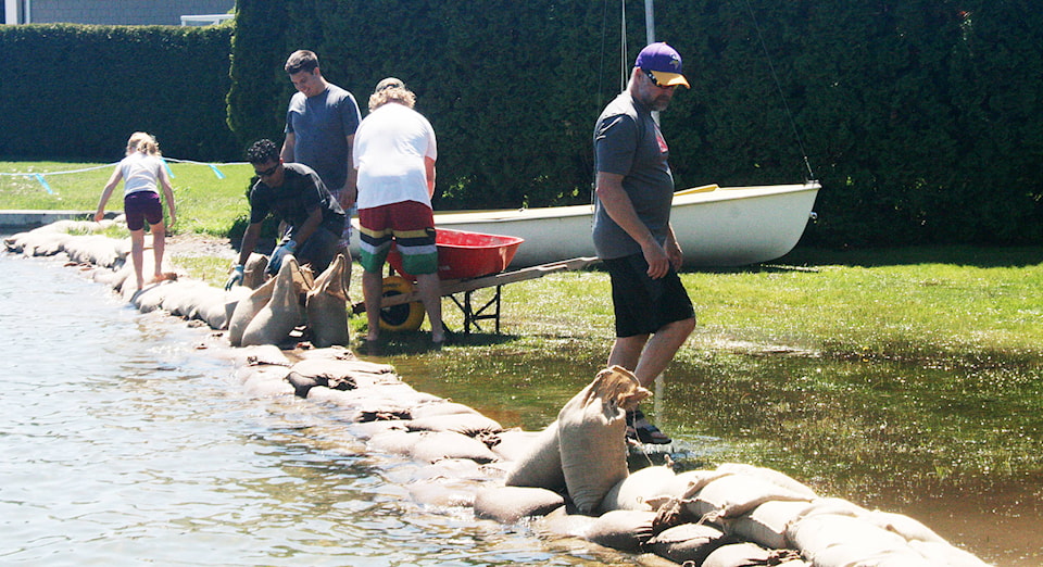
Residents living along the waterfront erected sandbag dikes as the water level in Okanagan Lake continued to rise on the weekend.
By Friday, the lake level had risen two centimetres from the previous day, to 342.76 metres — just 24 centimetres from the predicted high level of 343.0 metres.
Over the weekend, the water continued to rise and by Monday, some of the docks along Okanagan Lake were under water.
Because of the high water levels, the course for the Giant’s Head Grind race on Saturday was adjusted. The first part of the course traditionally follows a lakefront path from Peach Orchard Beach to the Summerland Waterfront Resort, but high water levels had left portions of the path under water by the time the race began.
Runners followed Lakeshore Drive to bypass the affected areas.
The municipality has closed the pathway at Landry Crescent, Centennial Trail along Peach Orchard Road and the path from Rotary Beach to the Peach Orchard boat launch.
In Trout Creek, residents were joined by volunteers from the rest of the community to fill sandbags and create dams at affected properties.
According to elevation mapping from the municipality, Trout Creek is the most susceptible to more widespread flooding.
Municipal representatives visited lakefront property owners on the weekend, providing information and discussing whether precautions have been taken to protect the properties from the predicted high water levels.
Sandbags and sand piles are still available.
Sandbags are available at the Summerland Fire Hall, 10115 Jubilee Road. Sand piles are in place at numerous sites near the lakeshore.
Earlier in the week, the municipality asked for volunteers willing to assist if the flooding risk increases.
“We received very good response from individuals, service groups and organizations willing to volunteer should flood conditions worsen,” Mayor Peter Waterman said. “It has been heartening to see so many Summerlanders helping each other protect property from the possible high water levels.”
Residents in low-lying areas are advised to check their basements and crawl spaces for ground water.
Because of the risk of water coming into a house through the electrical system conduit, homeowners near the water table should monitor their electrical panels regularly.
On Tuesday morning, Environment Canada issued a special weather statement for the Okanagan Valley.
Cooling temperatures, accompanied by strong winds were forecast for Tuesday night and Wednesday, with five to 10 millimetres of rain in places.
The strong winds, combined with high water levels, could result in increased wave action, which could affect shorelines and lakeside roads.
Because of the saturated ground, the risk of downed trees in strong winds has also increased.
The B.C. River Forecast Centre issues streamflow advisories and warnings. These warnings are updated at http://bcrfc.env.gov.bc.ca/warnings/index.htm.
Environment Canada also provides alerts and forecasts. To report severe weather conditions, send an email to ec.tempetepacifique-pacificstorm.ec@canada.ca or tweet reports using #BCStorm.
Information about flooding and high water conditions in Summerland is posted on the municipality’s Facebook page.